Looking out of the window we’re sure it’s here. Overcast sky, temperatures dropped to zero, freezing drizzles. That’s the less pleasant side of it. But let’s have look at it from the positive point of view – Alps covered with the first powder, and not only Alps. Also much smaller Krkonose or Jeseniky here in Czechia have dressed in white, luring us out to have some fun.
That means changing yourself into the winter mode – summer gear gets stored in a garage and out are coming cross country and downhill skis, snowshoes, snowbikes, skates, sledges… All the same, Locus has to switch to winter mode too – and the cornerstone of it are SKI MAPS!
Cross country ski routes and downhill ski slopes on map
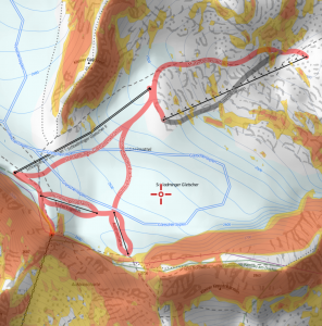
You no longer need to navigate hiking paths or bike trails – all these are buried under a meter of snow. You want to see where cross country tracks are laid, which ski slope to choose in vast Alpine resorts, which ski lift to take, what avalanche field to avoid. Check the difference:
Locus Store offers maps of two providers – Asamm LoMaps and Outdooractive Winter.
Great map detail and active POIs for a few bucks
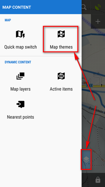
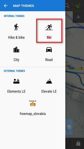
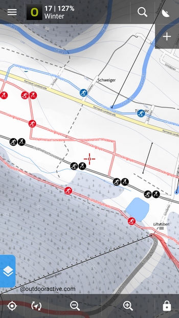
Asamm LoMaps, maps of Locus producer, can be easily switched into Ski theme:
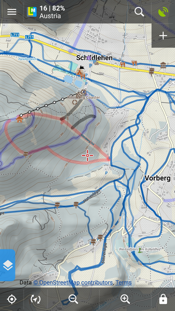
The map is styled according to the season and contains ski resorts, ski slopes with difficulty differentiated by color and maintained ski tracks:
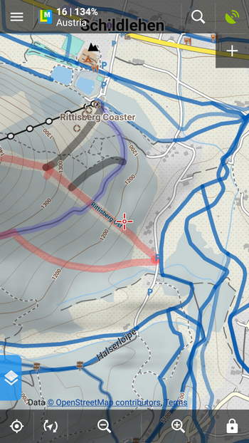
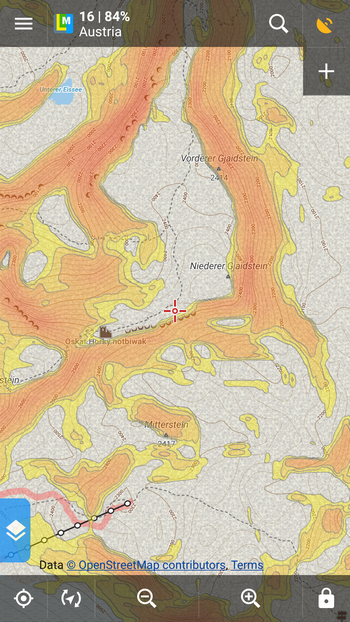
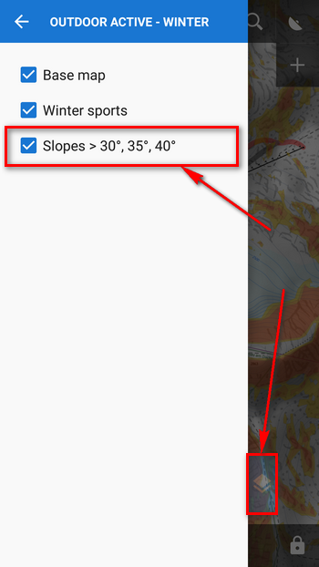
Skialpinists appreciate additional coloring of slopes steeper than 30°, 35°and 40° according to which they can avoid avalanche danger. Just go to Locus settings > Maps > Advanced > Map shading > turn Slopes on.
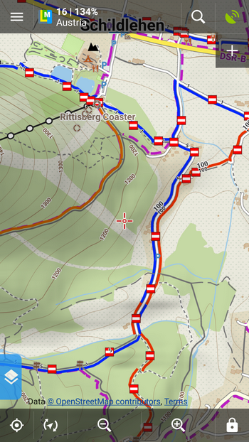
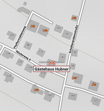
LoMaps can be zoomed in to a great detail so you can see house numbers and names of restaurants:
LoMap POIs can be browsed and searched separately (Locus menu > more functions > Points of interest):
Asamm LoMaps cover the whole world as they are rendered from OSM data. These data, however, are not detailed enough everywhere and in many countries the winter content is missing. On the other hand, first three LoMaps can be obtained for FREE, more updates for a symbolic price. For example, whole Austria costs about € 0.75.
Traditional high quality maps with rich content
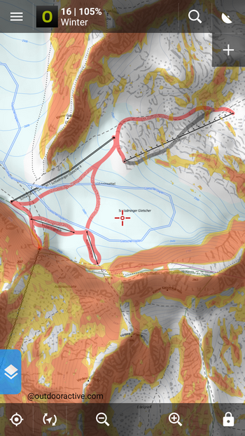
Another option for winter sport lovers are maps by Outdooractive. They cover Germany, Austria and Northern Italy and are much appreciated for their accuracy and rich content. They depict ski resorts, color-classified slopes, lifts, cableways as well. They differentiate cross country ski tracks by color too:
Colored slope gradients warning against risky avalanche areas can be displayed also on Outdooractive Winter maps. However, not via an additional feature as in LoMaps – slope gradients are just another layer of the map that can be switched on in the map theme panel:
Outdooractive Winter maps are available in Locus Store and you can purchase subscription for their online usage with 7 day FREE trial or buy pre-loaded offline map packages of the area you need.
So, first things first, we’ve got the map. Next time we’ll have a look at a few special winter feature tips. Cheers!
cross countryskiski mapski routeski trackskiingslopewinter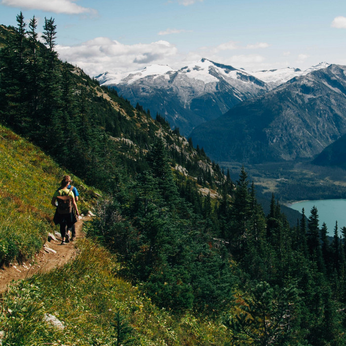
11 Comments
Useful subject indeed!
Maybe explore heatmaps from Strava? They can be lifesaving!
I'm in Norway and Ski theme isnt really useful...
https://www.dropbox.com/s/xn4x2x7uqjhsmfv/locus_theme_overlay.jpg?dl=0
Happy nordic skiing :-)
For people interested about ski touring in Switzerland, you can download the KML file "Skitouren als KML-Datei" from the Skitourenguru website at https://www.skitourenguru.ch/index.php/download
Unfortunately Outdooractive for Switzerland is not available in the Locus Store.
What I'm mostly interested is if there is a way to see the ski and snowshoe routes from Swisstopo in Locus (offline or online). Is it possible? Can I buy these routes? It would be great. Thanks
Hi Sylvain,
so far, Swisstopo provides only topographic maps in Locus. Michal, Locus team
What are the exact criteria for ski tracks to be rendered in Locus map (i.e. Asamm LoMaps)?
It seems insufficient for the an associated route to be tagged with piste:type=nordic etc. (https://wiki.openstreetmap.org/wiki/Piste_Maps).
Rather, the actual tracks seem to need the piste tagging. I couldn't find any source where to look that up properly. Thanks!
Dear Sebastian,
I hope I can understand your question. The relations and ways that have only piste:type=nordic are also shown in LoMaps (with internal themes). Please check that you use the latest LoMaps in version 2018.01.04. For this version were added also all routes with piste:type=nordic tag. Is there any route that isn't shown in the latest 2018.01.04 version?
Thank you
Dear Voldapet,
Thanks for the info. Having updated the software didn't improve things, but updating the map (LoMap offline) made it in fact work. The track in question is now rendered blue (in ski map view).
Just for completeness in case someone else has the same issue, the object in question was for example:
Way: 41390692
....
Tags:
"highway"="track"
"surface"="asphalt"
"tracktype"="grade1"
Part of:
Relation: Rennsteig Skiwanderweg (3850936)
...
This wasn't rendered as ski-track (i.e. blue) even though it was part of a route with the appropriate tags i.e. the route "Rennsteig Skiwanderweg" has the tags
piste:difficulty=intermediate
piste:grooming=classic
piste:name=Rennsteig Skiwanderweg
piste:type=nordic
As of the new version this seems sufficient, i.e. being part of a relation with the above "piste:" tags.
Thanks for the help, really enjoy Locusmap!
Dear Sebastian,
the problem was in "SKI" relations that weren't shown till the latest version (2018-01-04) of LoMaps. It's fixed now.
Thank you
Petr
Thank you very much for the excellent wintermaps! I have question: How can I let the path with the routeplanning tool stick on the crosscountry skiing slopes / routes? I have not managed to do so. Any ideas? Thank you, Peter
Hi Peter,
Locus Map uses services of third parties for routing - BRouter or GraphHopper. According to our test, none of them provides XC skiing routing profile. Therefore, only the manual mode is the way of planning routes along ski routes.
can you update ski theme in georgia map? there are some new lift and routes
Hi,
we are not the map data producers - LoMaps are generated from OpenStreetMap data (Openstreetmap.org). If you need to mark an error in map, use OSM notes in Locus menu or go to OSM website directly (you can become a OSM mapper yourself, it is an open community). Michal, Locus team