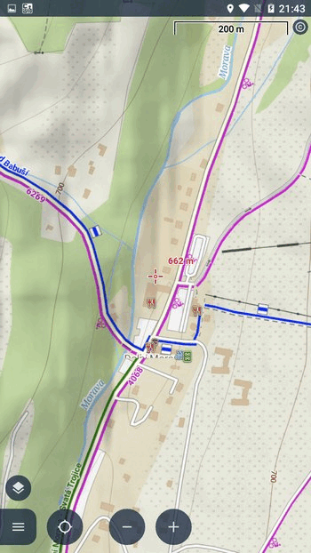
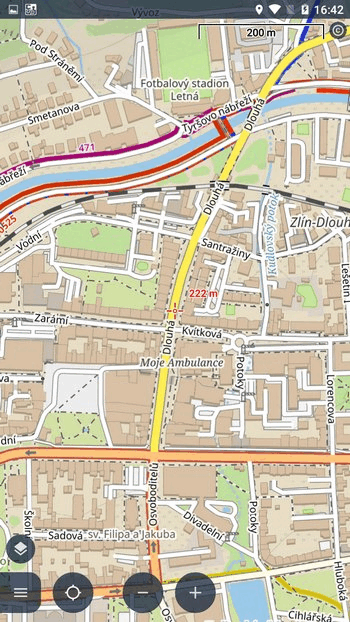
Although the map is the main thing you see when you turn on Locus Map and what you need to work with it, the app can display much more on the main screen. The map itself can contain multiple layers – points of interest LoPoints, terrain shading, various overlays… On top of that you can see user points and routes, plus various ancillary graphics like lines, circles, coordinate grids, etc. Today we’ll see what all can be displayed on the main screen, and also how to “clean up” the screen as quickly as possible.
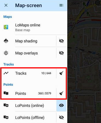
Content panel
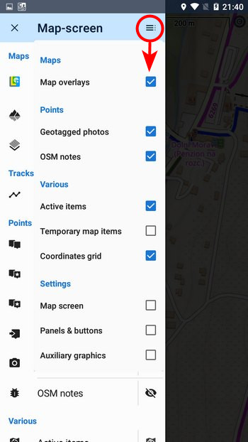
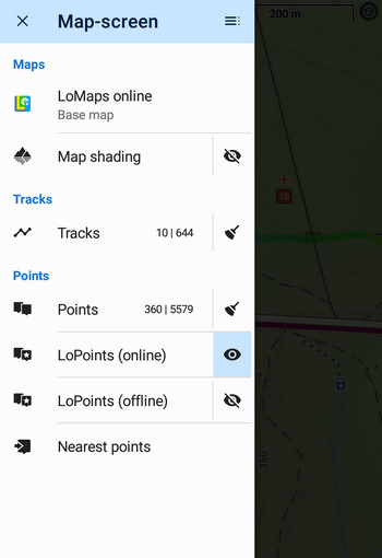
You’ll find the place where it’s all controlled near the left edge of the display.
The content panel has a series of toggles and buttons, divided into several thematic headings:
- Maps
- Tracks & Routes
- Points
- Miscellaneous
- Settings (disabled by default)
As is common with Locus Map, you can customize the content panel to suit your needs – turn on the toggles you use and hide the ones you don’t. A selection of options can be found in the top bar of the panel. You’ll also find three settings items that are hidden in the default panel configuration.
The map is essential
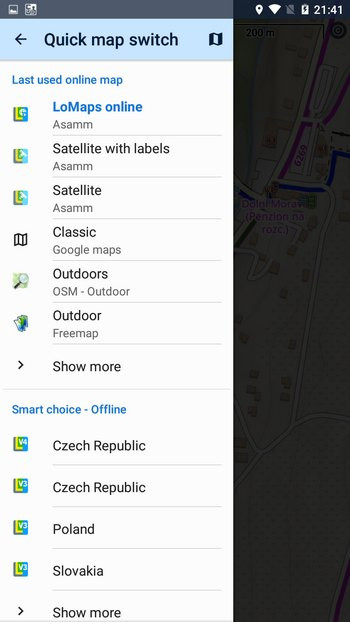
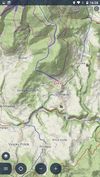
Although a robust map manager is available for managing maps in the app, a toggle switch in the content panel is preferable for quickly viewing and changing maps on the main screen. Tap on the name of the currently displayed map to open a menu of recently used online maps and downloaded offline maps covering the local area. And since the vast majority of users use no more than about 3 maps at a time, the quick switch is the best solution.
Hike, bike or a city?
Some maps, such as our LoMaps, can be switched to different themes depending on how they are used.
If you have such a map active, a theme switcher will be added to the content panel.
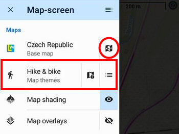
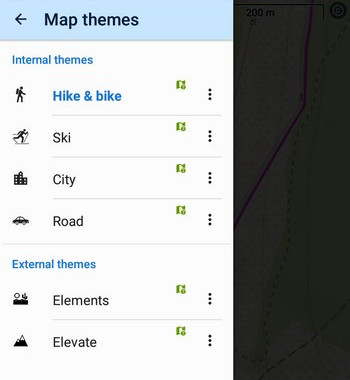
This consists of three buttons. The first selects the theme itself – for LoMap this is Hike and Bike, Ski, City and Road.
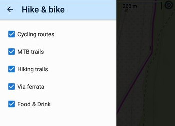
The next button will show you the legend of the map you are using if you are unsure of a marker on the map. The third button shows the map theme layers, which can be shown or hidden as needed. For example, a hiker doesn’t need to see bike route markers.
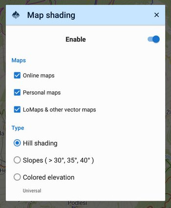
Shading or slope gradients?
Locus offers shading to make the terrain on the map more plastic. While the classic “eyelet” toggles shadows on or off, tap the button name to see additional options – for which maps to show shadows, and also the type of shading.
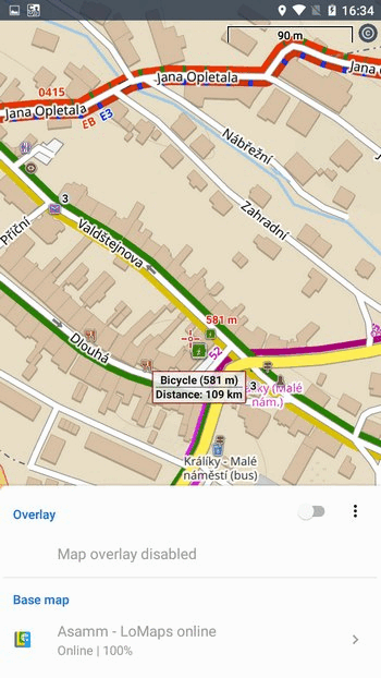
A map over a map
If one map is not enough, Locus Map can display two map layers on top of each other. Click the button to open the overlay map selection dialog with a transparency slider.
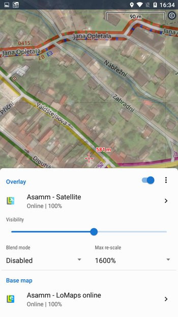
Use the eyelet to toggle the overlay on or off.
Places on the map
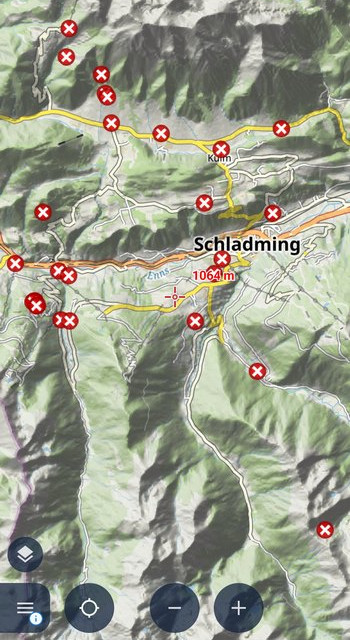
An integral part of the map are points of interest and information about them – LoPoints. Online LoPoints are always available when you are connected, offline LoPoints are downloaded together with the LoMap of the area. You can view them over any map, including satellite maps. Here you can easily show or hide them all at once.
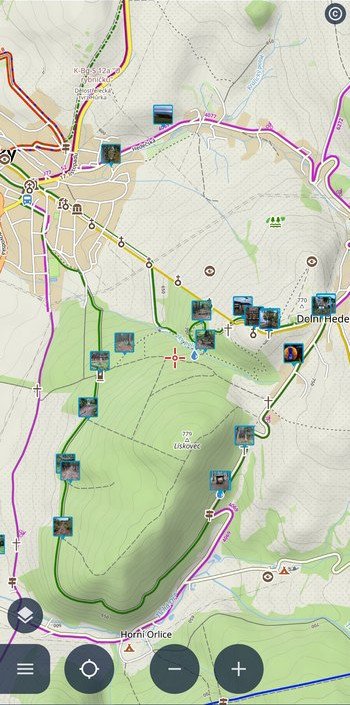
My points and routes
You control the display of your own points and routes directly from My Library. You can activate them individually, in groups or in whole folders. In the content panel, you will find only the main “switches” to turn all displayed points and routes OFF.
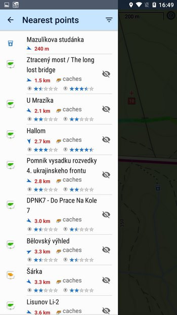
Which place is the closest?
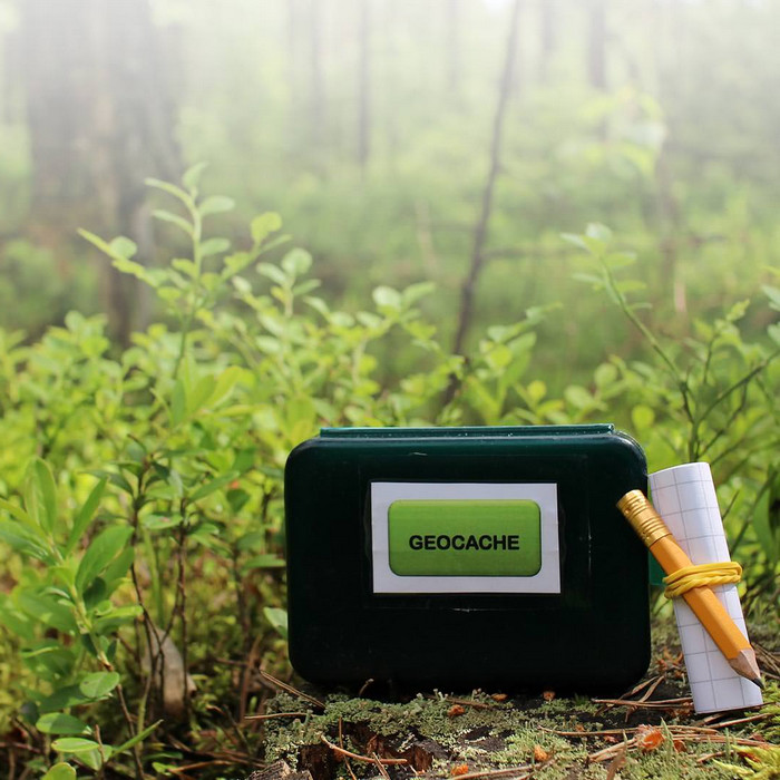
This button does not turn on anything on the map, but instead pulls the closest points in the selected category from the map and sorts them according to their distance from you. You have a choice of LoPoints, caches, user points, users visible via live tracking and more.
Photos
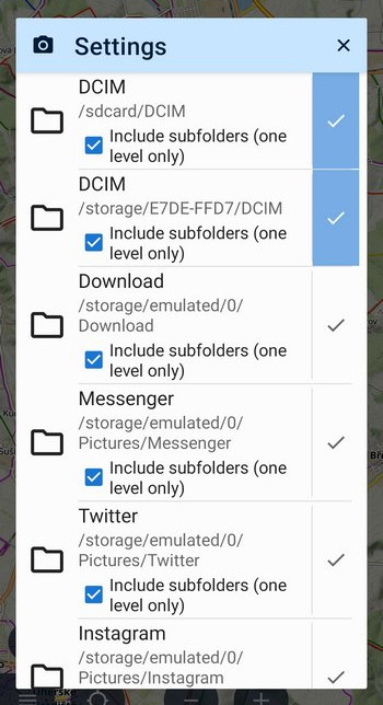
Photographs taken with a mobile phone usually include information about the exact location of the photo. Tap on the “eye” to view these photos above the map.
Locus Map can display not only your own photos, but also images sent via Whatsapp and other social media. Tap the button name to set which folders Locus Map will take photos from.
Something for geeks
Mapper’s notes
OSM notes are a specific layer for those of you who want to contribute to the improvement of the map. Just by turning on the layer you can see the places where there is some error in the map. If you click the full button, you can report the map error or change to the OSM mapping community yourself.
Active items
Behind the somewhat mysterious and generic name is the ability to control the display of external geodata files (custom maps, routes, points…) that are added to the app via “Map Items”. Here you expand the list of their layers and set the transparency. A bit too much digital wilderness for the average hiker or biker, so you can deactivate this option in the panel settings with peace of mind.
Would you like some more graphics?
Grids
A layer for old-timers and map lovers who are not satisfied with the map location and coordinates in the top panel. Here they can turn on the WGS or UTM coordinate grid, or the kilometer grid.
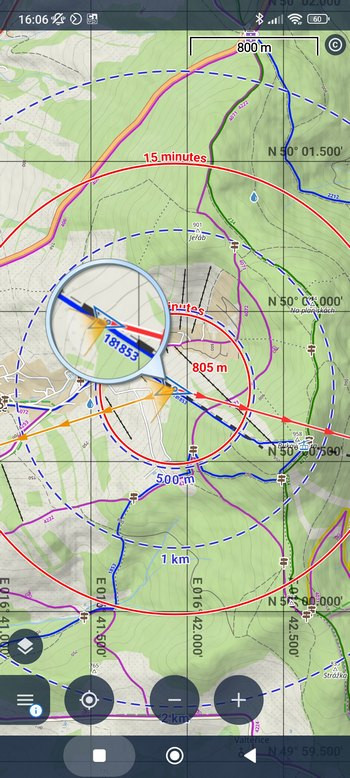
Lines and circles
We’ve also added the option to turn on the graphical tools settings in the content panel – it’s not in the basic menu, you have to activate it in the panel configuration (see above). This way you can quickly turn on time and distance circles, orientation and direction lines, magnifying glass and other elements.
Clean up!
So we have a lot of content, the map is full of routes, caches and various other graphical ballast. How do we quickly get back to just the map?
- You can hide all your tracks, routes and points with one (or two) buttons with a broom symbol.
- LoPoints are also easy to get rid of, just select which one you’re currently using – online or offline – and tap the eyelet.
- Similarly, you can quickly hang up photos, notes or the grid.
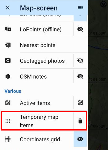
However, there are still some features hanging around on the map that you’ve added using the graphical geocaching tools, or caches that streamed in while using the live map… These are all reliably removed by the “Temporary map items” button with the trashcan symbol. It’s not in the default panel menu, but if you frequently work with the live map or various cachers’ tidbits, activate it.
Since Locus Map handles a lot, there’s quite a bit in the content panel as well. If you don’t use everything we’ve written about here, remember that you can disable unnecessary features! This will make the panel much more concise and clear:

28 Comments
Distance circles only show for a few seconds and then disappear
Hi, if you have any problems with the app, please contact us at the helpdesk at help.locusmap.eu and send detailed description of the issue.
The nicest thing is the transfer to my SmartWatch: It works perfect. I use it dozens of time at a hike.👍👍👍
Which smart watch do you use?
I use Galaxy Watch5 with Lotus and it works great.
Locus, of course.
Ja das würde ich auch gerne wissen. Welche Smartwatch unterstützt Locus?
I wish that you could set the visibility/transparency of the shaded map overlay. I like this overlay, but it can be a little too dark.
Dear Gerhard, which watch are you using?
Thanks!
It'd be awesome if we could also change a map color mode, especially activate and deactivate night mode (and/or "change automatically" option) in such an easy, convenient way, instead of having to dive into the settings three levels below. This would be really useful for me, even more than map themes.
Hi Piotr, it is possible to switch map night mode automatically. Go to settings > maps > advanced features > map color mode > activate it and check the option "change automatically".
Trzymanie środka mapy mogłoby być na środku wyświetlanego obszaru ale na dole ekranu żeby było widać więcej treści mapy, drogi którą sobie wyznaczyliśmy do pokonania i tego co przed nami a nie to co już przebyliśmy i jest za nami.
Hi Artur, go to settings > controlling > map screen > shift map cursor - turn it on. The cursor will be closer to the bottom by 1/4.
Geotag-Fotos: Wie kann ich ein Verzeichnis für Fotos hinzufügen? Die Funktion ist schön, aber ich habe meine Touren in Unterordnern in 2. Ebene abgelegt: Fotos/Jahr/Tour...
Hi Thomas, unfortunately, Locus Map can read only 1 sublevel of the photo folders.
Boa tarde
Adoro esta App infelizmente perdi alguns trilhos que fiz e gravei, no entanto sumiram e não os encontro. Como posso acessar á "nuvem".
Obrigado
Hi, if you have any problems with the app, please contact us at the helpdesk at help.locusmap.eu and send detailed description of the issue.
Hello, thank you so much. This application is emasing. We used it for a bicycle tour in Slovenia and enjoyed it so much. Really accurate and easy, so many details. Thanks and we'll done.
Mám mapy Locus.
Ako sa dá nastaviť mapy, aby mi ukazovali aj čísla ciest 1,2,3 triedy + rýchlostne cesty + dialnice. Lebo mi chýbajú, a mám v tom guľáš.
Vopred Vám ďakujem.
Braňo zo Slovenska
Dobrý den, od chystané verze Locusu se budou čísla silnic zobrazovat v offline LoMapách.
Quali sono le impostazioni più funzionali per il GPS quando sta registrando una traccia. Ho riscontrato che non è corretto il dislivello e la registrazione della traccia si discosta dalla quella indicata sulla mappa.
Hello,
Locus Map processes elevation gain from the data it receives from your phone GPS. If the data is incorrect or contains huge deviations, then the resulting elevation gain is also incorrect. Locus Map, however, offers a few methods on how to limit these deviations.
Open Locus settings > GPS&sensors:
- Location filter > select medium or heavier filter
- Google Services assisted location > turn it ON
- Altitude manager > settings tab > SRTM data - select "Optimize GPS values" or better "Replace GPS values"
- Altitude manager > settings tab > Pressure sensor > turn ON (if available)
- Altitude manager > settings tab > Altitude filter - select medium or heavier filter
Still no iOS version 😔
Hi,
we've been testing an iOS version for some time. You can join, if cou want. More at https://help.locusmap.eu/topic/32424-locus-map-lite-ios-beta-program-open-for-new-testers.
Congratulations! I found your App by investigating cartographic maps, because I am learning to program with dart on flutter plattform to create a simple app about an area I have been living for many years. Your example is a dream or an vision, how a perfect mapping app should work! Go on this great work!
Geotagged photos noway appear on map on Locus Map 4. It even doesn't show all possible directories of pictures of different social media as shown in your example. Also those directories witch are shown are full of photos, but it seems that Locus Map 4 doesn't see them.
But on Locus Map Classic everything work nice on the same phone.
I very like this feature, but never succeded activate it on LM4
Please contact the support team at help.locusmap.eu and send all details regarding the issue, including screenshots. We'll gladly help.